Plot Deed
Surety® Pro’s Plot Deed tool is a basic deed plotting that creates boundaries based on metes and bounds descriptions. This is an easy-to-use system for use by real estate professionals, land title companies, assessor’s offices, appraisers, legal and land surveyors, property buyers, property owners, and investors right inside the already all-purpose Surety® Pro Mapping subscriptions. The Plot Deed tool will calculate straight lines, curves (cords or tangent deflection), convert a variety of different measurement units (chains, feet, furlongs, links, miles, rods, and varas), acreage, magnetic declination, and will easily close the polygon after all segments are mapped.
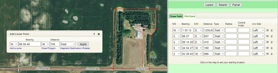
Simply click on the map to set the starting point and you are ready to go. After that is just a matter of typing in the degrees and distances and selecting the directions and units on each segment. Surety® Pro will display a history of all the entered segments where they can be modified at any time. Once a boundary is completed, enjoy the full gamut of features that Surety® Pro offers including exporting them as shape files or KML files for use in other mapping software or devices.
For more information, please Contact Us directly.