Financial Institutions
Continually Adding Up the Benefits
To be fruitful in business requires hard work and intelligent decision making. Surety® Customized Online Mapping works hard for you and in return presents an easy decision to make. When you get down to it, success depends on efficiency in the workforce. Efficiency comes naturally with Surety® as your mapping solution. Compiling information for a job is often cumbersome, complicated, and time-consuming. Surety® places a multitude of resources at your disposal that eliminates an otherwise frustrating and tedious process when using other means. Even more, Surety® is very quick to learn, making it a value for any employee’s experience level.
 |
 |
 |
|---|---|---|
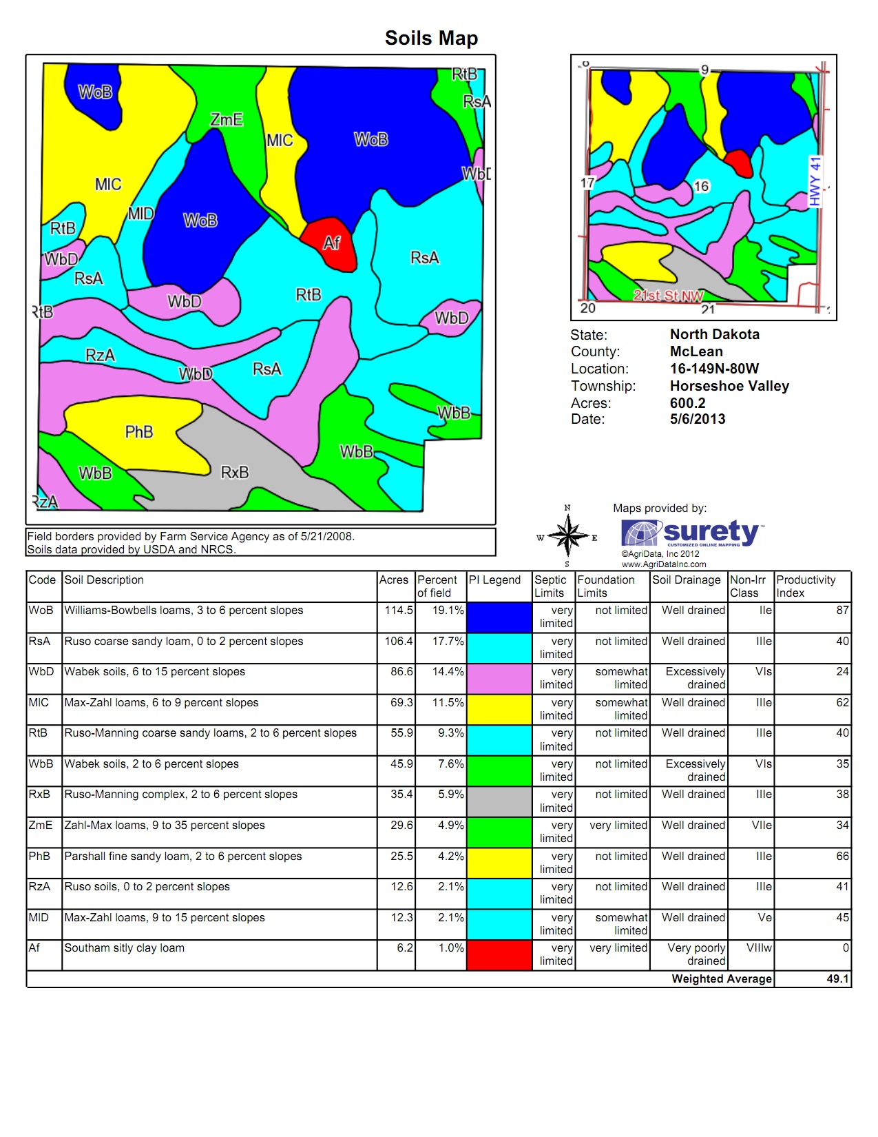
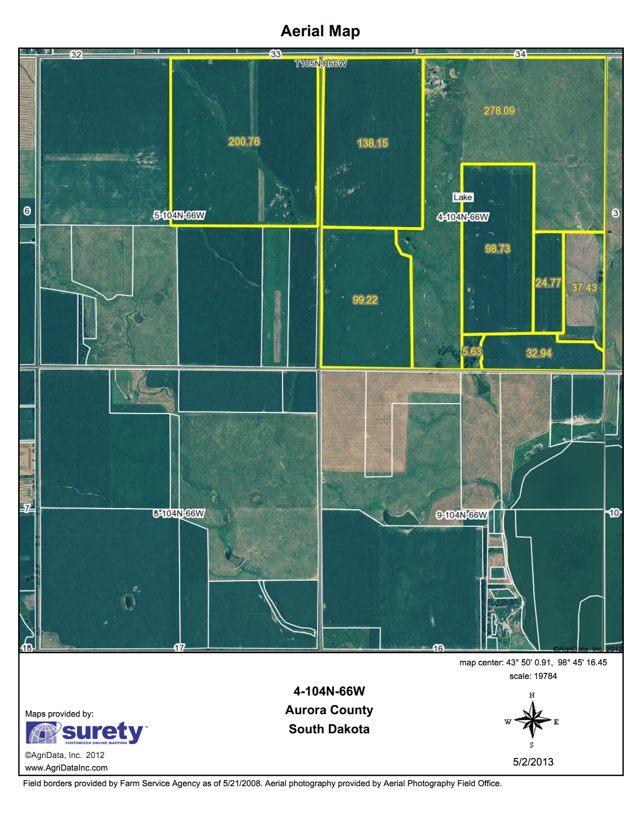
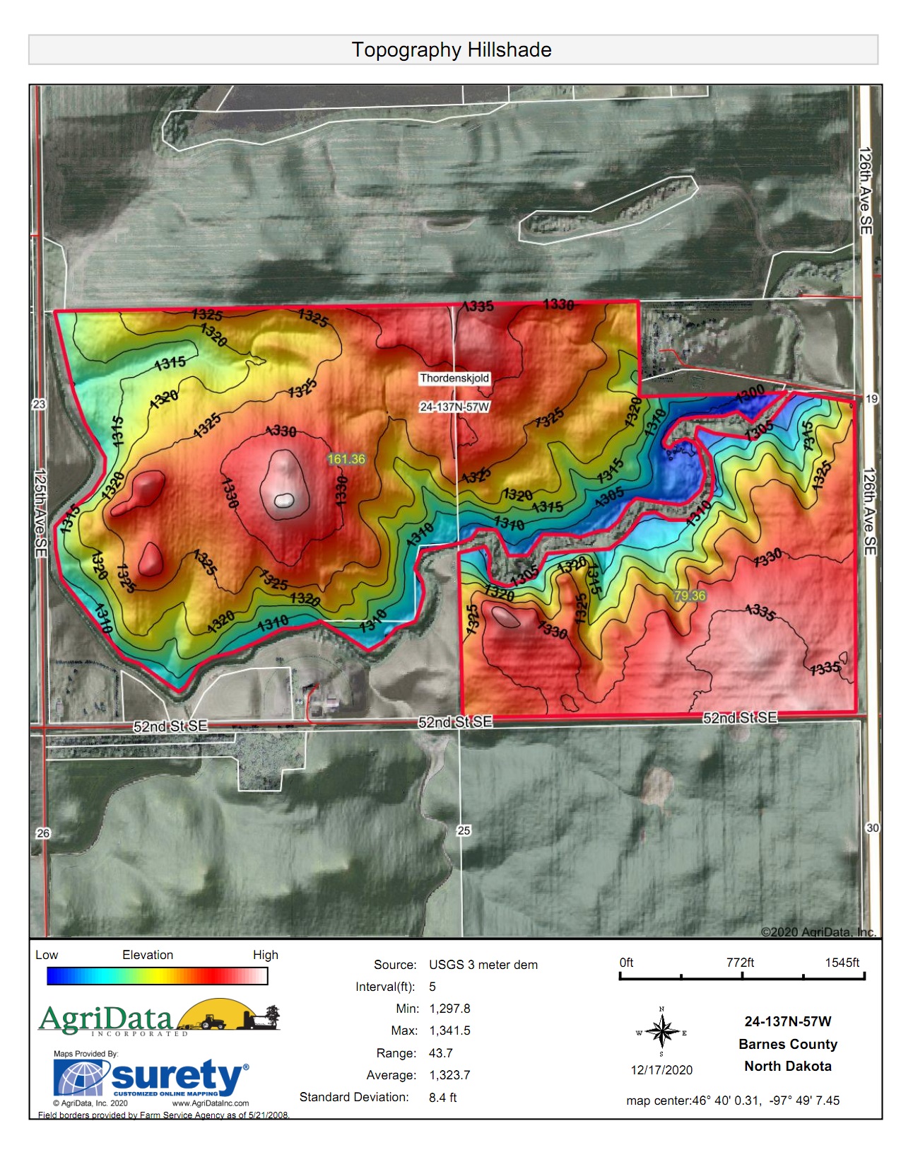
| Soil Map | Aerial Map | Topo Hillshade Map |
Important Features for Financial Institutions:
- Soil Data Reports
- Aerial Imagery Maps
- Drawing tools to verify acreage
- Location Search (Section, Township, Address, Lat/Long, TX Blocks)
- FEMA Flood Zone data & FEMA Determination Forms
- Topography Maps
- Parcel Data* including ownership boundaries and information
* Parcel Data is an add-on feature. See: Parcel Data Information
For more information, please Contact Us directly.